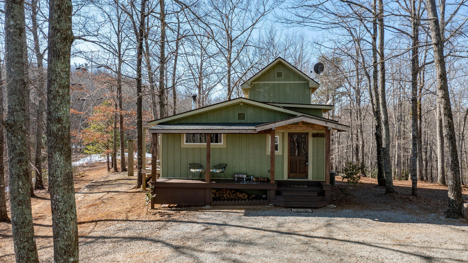
Property Record
26 W Fork Creek Rd, Saluda, NC 28773
NEARBY LISTINGS FOR SALE OR LEASE
-
-
View all Saluda listings for sale on LoopNet.com
Property Detail
26 W Fork Creek Rd
P15-7
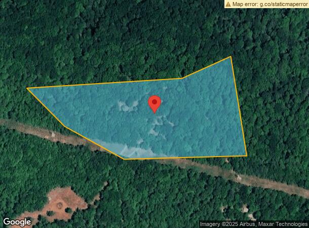
Map P15
Realpropertynec
11.75 ACRES, P15 MAP P15
X
Polk
3710050400J
North Carolina
2024
11.75 AC
2024
North Carolina West/Cherokee Area
920304
Other Market Areas
952 SF
DEMOGRAPHICS near 26 W Fork Creek Rd
1 Mile
3 Mile
5 Mile
2024 Total Population
139
2,519
6,470
2029 Population
151
2,744
7,044
Pop Growth 2024-2029
+ 8.63%
+ 8.93%
+ 8.87%
Average Age
50
50
50
2024 Total Households
63
1,138
3,014
HH Growth 2024-2029
+ 9.52%
+ 9.05%
+ 9.02%
Median Household Inc
$66,562
$61,610
$61,262
Avg Household Size
2.20
2.10
2.10
2024 Avg HH Vehicles
2.00
2.00
2.00
Median Home Value
$252,499
$271,806
$283,284
Median Year Built
1969
1975
1977
Nearby Places
- Restaurants
- Banks
- Shops
- Fitness
- Groceries
PUBLIC TRANSPORTATION
AIRPORT
Asheville Regional
DRIVE
WALK
Distance
Asheville Regional
48 min
27.1 mi
Greenville Spartanburg International
DRIVE
WALK
Distance
Greenville Spartanburg International
73 min
35.0 mi
Freight Ports
North Charleston Terminal
DRIVE
WALK
Distance
North Charleston Terminal
269 min
227.9 mi
SALE & LEASE HISTORY
LISTING DATE
SALE/LEASE

Feb 19, 2022
For Sale
Nearby Properties
Address
Land Use
TOTAL SIZE
Lot Size
Zoning
Address
Land Use
TOTAL SIZE
Lot Size
Zoning
17,219 SF
6.27 AC
M
Address
Land Use
TOTAL SIZE
Lot Size
Zoning
4.68 AC
M
Address
Land Use
TOTAL SIZE
Lot Size
Zoning
279.90 AC
1011478~R2
Address
Land Use
TOTAL SIZE
Lot Size
Zoning
318.36 AC
MX
Address
Land Use
TOTAL SIZE
Lot Size
Zoning
4,808 SF
3 AC
M
Address
Land Use
TOTAL SIZE
Lot Size
Zoning
2,922 SF
10.79 AC
MX
Address
Land Use
TOTAL SIZE
Lot Size
Zoning
2,534 SF
16.94 AC
MX
Address
Land Use
TOTAL SIZE
Lot Size
Zoning
5,562 SF
7.78 AC
HC
Address
Land Use
TOTAL SIZE
Lot Size
Zoning
1,822 SF
1.41 AC
M
Address
Land Use
TOTAL SIZE
Lot Size
Zoning
220 AC
MX
Address
Land Use
TOTAL SIZE
Lot Size
Zoning
2,602 SF
1.70 AC
M
Address
Land Use
TOTAL SIZE
Lot Size
Zoning
864 SF
31.51 AC
601759~R3
Address
Land Use
TOTAL SIZE
Lot Size
Zoning
200 AC
MX
Address
Land Use
TOTAL SIZE
Lot Size
Zoning
1,800 SF
22.98 AC
MX
Address
Land Use
TOTAL SIZE
Lot Size
Zoning
0.48 AC
M
Address
Land Use
TOTAL SIZE
Lot Size
Zoning
10,320 SF
1.97 AC
M
Address
Land Use
TOTAL SIZE
Lot Size
Zoning
1.32 AC
M
Address
Land Use
TOTAL SIZE
Lot Size
Zoning
1,972 SF
25.09 AC
MX
Address
Land Use
TOTAL SIZE
Lot Size
Zoning
8,496 SF
5.31 AC
HC
Address
Land Use
TOTAL SIZE
Lot Size
Zoning
4,151 SF
1.18 AC
M
Address
Land Use
TOTAL SIZE
Lot Size
Zoning
3,600 SF
8.12 AC
1013303~R3
Address
Land Use
TOTAL SIZE
Lot Size
Zoning
2.06 AC
9936536~WR
Address
Land Use
TOTAL SIZE
Lot Size
Zoning
111.99 AC
MX
Address
Land Use
TOTAL SIZE
Lot Size
Zoning
11,250 SF
1.70 AC
HC
Address
Land Use
TOTAL SIZE
Lot Size
Zoning
9,040 SF
1.36 AC
Address
Land Use
TOTAL SIZE
Lot Size
Zoning
2.39 AC
Address
Land Use
TOTAL SIZE
Lot Size
Zoning
28.47 AC
MX
Address
Land Use
TOTAL SIZE
Lot Size
Zoning
3,300 SF
0.19 AC
M
Address
Land Use
TOTAL SIZE
Lot Size
Zoning
78.50 AC
Address
Land Use
TOTAL SIZE
Lot Size
Zoning
2,688 SF
0.87 AC
M
The World's #1 Commercial Real Estate Marketplace
Connect with us
© 2025 CoStar Group
The information above has been obtained from sources believed reliable. While we do not doubt its accuracy we have not verified it and make no guarantee, warranty or representation about it. It is your responsibility to independently confirm its accuracy and completeness. Any projections, opinions, assumptions, or estimates used are for example only and do not represent the current or future performance of the property. The value of this transaction to you depends on tax and other factors which should be evaluated by your tax, financial, and legal advisors. You and your advisors should conduct a careful, independent investigation of the property to determine to your satisfaction the suitability of the property for your needs.